
Out in the Boonies
What's New Packing List Guest Book
Hiking notes for Florida wild places
This site collects practical hiking information for public lands that sit a little off the beaten path in Central and South Florida. You will find trail descriptions, photos, topo maps, GPS downloads, and driving directions that are written for people who already enjoy heat, humidity, and the slow pace of pine flatwoods and river swamps.
Each area page focuses on what you will see on the ground: trailheads, loop options, boardwalks, seasonal water levels, and wildlife you might notice if you move quietly. Details change when agencies reroute trails or close gates after storms, so treat every trip as a reason to double-check posted rules, fees, and hours before you leave home.
Use the regional tables below to jump straight to a place you want to explore. Red link text marks spots that tend to draw steady weekend traffic or need a little extra planning for parking and permits.
For a day-hike packing checklist tuned to Florida heat, storms, and hunting overlap, open the Florida day hike packing page, then return here to pick your next trail.
South Florida
Arbuckle Tract Chandler Slough Kissimmee Prairie Avon Park Hickory Hammock Micco Landing Boney Marsh Kicco Yates Marsh
Before you head out
Carry more water than you think you need, wear a hat and sun protection, and plan for afternoon thunderstorms in the warm months. Many of these tracts share space with hunting seasons, cattle leases, or controlled burns, so bright clothing and a quick review of agency alerts can keep a simple day hike predictable.
If you spot a broken boardwalk, a missing blaze, or a closed gate that is not mentioned on the area page, assume conditions changed after the last update. Local ranger stations and county conservation staff are the best source for the final word on access.
Most destination pages include printable topo maps and GPS files where they are available. Download copies before you lose cell service, and keep a paper map as backup when you are deep in scrub or swamp where screens wash out in bright sun.
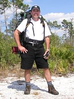
The Boonie Man